East Tennessee Weather II

Looks like the Euro model is actually calling for more than the GFS model now. Funny.

Yeah, I’m interested to see what the short models are going to show. The 6Z GFS basically follows suit with the EURO. So it seems like they have came to an agreement. It’s just going to come down to timing.
 
Looks like the models are all pretty well aligned in this being an inch or less. Any updates from our resident experts? I haven’t seen Metvol weigh in and I’m anxious to see that as he was spot on last year.
 
Looks like the models are all pretty well aligned in this being an inch or less. Any updates from our resident experts? I haven’t seen Metvol weigh in and I’m anxious to see that as he was spot on last year.

I think the biggest story weather wise for Chrismas weekend is the frigid temperatures and dangerous wind chills. We will likely see single digit lows and wind chill values between 0 and -15°.
 
To add to my last post, we might get to see something that is rarely issued in the valley on Friday night. That rare thing is a wind chill advisory. The criteria for an advisory is -5 to -14° wind chill and at least 10 mph winds for 3+ hours.
 
6Z GFS trending back. Let’s see how the next run does. Euro still holding steady & CMC still trending with the GEFS
 
To add to my last post, we might get to see something that is rarely issued in the valley on Friday night. That rare thing is a wind chill advisory. The criteria for an advisory is -5 to -14° wind chill and at least 10 mph winds for 3+ hours.

*IF* we see snow, it’ll only add to the cold as well.
 
Still on an island. Im not sure how this will unfold.

It’s majorly going to depend on how quick the cold air moves over the plateau.
 
If you have a dog or another pet that you keep outside, it's best to move them indoors this weekend. We will be lucky to get into the teens for the high temperature on Friday.
 
  • Like
Reactions: headhunter15
If you have a dog or another pet that you keep outside, it's best to move them indoors this weekend. We will be lucky to get into the teens for the high temperature on Friday.

Adding to this, if you’re going to be out of town it’s best to leave your cabinets open and set the heat a degree or two higher.
 
VK, Do you expect a Wind Chill watch to be issued?

If models keep trending back we may see a Winter weather advisory issued!
 
Last edited:
VK, Do you expect a Wind Chill watch to be issued?

If models keep trending back we may see a Winter weather advisory issued!
I’m not sure what models you’re using but the ones I see are calling for a dusting. Strangely, the GEM (I have no idea what that means) is calling for something pretty nasty mid to late next week but none of the other models are showing it.
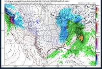
 
I’m not sure what models you’re using but the ones I see are calling for a dusting. Strangely, the GEM (I have no idea what that means) is calling for something pretty nasty mid to late next week but none of the other models are showing it.

Aside from the snow, I could see a WWA or a special weather statement being issued for the potential of flash freezing on the roads from leftover moisture Thursday night into Friday morning.
 
  • Like
Reactions: hUTch2002
VK, Do you expect a Wind Chill watch to be issued?

If models keep trending back we may see a Winter weather advisory issued!

I would think the mountains are definitely in play for a WC watch. I still think the valley has a decent chance of seeing a WC advisory.
 
I’m not sure what models you’re using but the ones I see are calling for a dusting. Strangely, the GEM (I have no idea what that means) is calling for something pretty nasty mid to late next week but none of the other models are showing it.


That’s the fun part of model watching. The trends and outliners. The GFS and EURO tend to lose storms or get lost between 60-120 hours and pick them back up. I don’t trust the NAM until the 48 hour range.

I’m not saying we will see a significant storm but we could bust high with this setup.

This run isn’t over yet but as you can tell the 12Z GFS is trending back with this run and with the previous 2.

*If* we see accumulating snow I suspect we could see wind chills in the negative teens.
64991D6C-805D-4B99-9131-82EC44048F3C.jpeg
 
That’s the fun part of model watching. The trends and outliners. The GFS and EURO tend to lose storms or get lost between 60-120 hours and pick them back up. I don’t trust the NAM until the 48 hour range.

I’m not saying we will see a significant storm but we could bust high with this setup.

This run isn’t over yet but as you can tell the 12Z GFS is trending back with this run and with the previous 2.

*If* we see accumulating snow I suspect we could see wind chills in the negative teens.
View attachment 525329
Yeah that’s got an inch or so. I admittedly don’t know much about weather forecasting but I enjoy it, especially this time of year. Are you a meteorologist or is this a hobby?
 
Yeah that’s got an inch or so. I admittedly don’t know much about weather forecasting but I enjoy it, especially this time of year. Are you a meteorologist or is this a hobby?

It’s a hobby lol.

The way I look at weather models is how a carpenter looks at his tools. The NAM is the hammer, the GFS is the square and the Euro would be the measuring tape. We have to use what we have to make an educated forecast.

Pivotal weather has some better models to use. Tropical has the standard 10:1 ratio while Pivotal has the kuchera that is typically more accurate.

I’ll make my far fetched guess after the next run.
 
  • Like
Reactions: hUTch2002
I think we see widespread 1-3 with 2-4 in isolated pockets area wide. There’s a potential to bust higher with this setup and there’s a potential we don’t see anything. Like VK said, the main threat is the cold along with the flash freeze.
 
Watch Alert!!!

...WIND CHILL WATCH IN EFFECT FROM LATE THURSDAY NIGHT THROUGH
SATURDAY AFTERNOON...

* WHAT...Dangerously cold wind chills possible. Wind chills as low
as 15 below zero in lower elevations, and as low as 25 below
zero in higher elevations.

* WHERE...Portions of southwest North Carolina, east Tennessee
and southwest Virginia.

* WHEN...From late Thursday night through Saturday afternoon.

* IMPACTS...The cold wind chills could cause frostbite on
exposed skin in as little as 30 minutes.

* ADDITIONAL DETAILS...Wind gusts on Friday are expected to be
between 30 and 50 mph. Winds this strong may result in downed
trees and power lines, which may cause power outages while
temperatures are extremely cold.


PRECAUTIONARY/PREPAREDNESS ACTIONS...

A Wind Chill Watch means the there is the potential for a
combination of very cold air and strong winds to create
dangerously low wind chill values. These conditions can quickly
result in frost bite...and can lead to hypothermia or death if
precautions are not taken. Monitor the latest forecasts and
warnings for updates on this situation.

If you plan to use alternative sources of heat or electricity in
your home, be careful. Observe all safety precautions to avoid
carbon monoxide poisoning, electrocution, or a fire. Portable
generators should be operated outdoors in a dry and well
ventilated area
 

VN Store


Back
Top