East Tennessee Weather II

That was crazy to see the GFS and Euro both take away the frigid cold today. Looks like the moisture could be gone, too.

The GFS and CMC are showing brutal cold the week after next, but who knows anymore? Haha
Yeah I'm always a little skeptical of it, especially with the same models showing no strong +PNA pattern (so no signal for really lasting cold air). I'll say that it doesn't look like a lot of warmth the next couple weeks regardless (and I'm ready for spring).
 
  • Like
Reactions: headhunter15
Yeah I'm always a little skeptical of it, especially with the same models showing no strong +PNA pattern (so no signal for really lasting cold air). I'll say that it doesn't look like a lot of warmth the next couple weeks regardless (and I'm ready for spring).

I’d like one more decent snow and then I’ll be ready for spring. I want to use all of our snow days!
 
  • Like
Reactions: MetVol
Looks like East TN could see some snow Saturday night into Sunday morning.
It's trending more interesting. All depends on how much phasing we get between two northern and southern stream shortwaves. Decent phasing of the two would give us a more amplified trough and a stronger system with higher snow potential. Still a ton of uncertainty with this system. As these small shortwaves are better assimilated into numerical guidance over the next 24 hours when they get over North America, this should help modeling resolve the forecast better (in theory). I'll be curious to see what the GFS and GFS ensembles show tonight at 0z and in the morning at 12z.
 
  • Like
Reactions: headhunter15
The latest discussion from Morristown:

Main focus will be the Saturday afternoon through early Sunday
morning system. The vertical temperature profile makes this
forecast, as always, tricky and quite variable across the forecast
area. Will rely heavily on ensembles to help fine-tune the area
forecast but latest operational model runs of the NAM, GFS, and
ECMWF are aligning to a potential significant snowfall.
Is this including the valley, or just the upper elevations?
 
Also, bear in mind the threat isn’t just snow or ice. There’s the possibility of prolonged sub-zero temps later next week, depending on how far south the arctic airmass can get.
 
  • Like
Reactions: headhunter15
This possibility of snow seemingly developed all of a sudden. The lows are in the mid 30s so that makes me wonder if we will end up with a cold rain as we’ve seen that a lot this Winter. I’ve never seen a Winter with so many rains between 33 and 39 degrees. For the valley will this be more of the same?
 
This possibility of snow seemingly developed all of a sudden. The lows are in the mid 30s so that makes me wonder if we will end up with a cold rain as we’ve seen that a lot this Winter. I’ve never seen a Winter with so many rains between 33 and 39 degrees. For the valley will this be more of the same?
Wouldn't be surprised if we see some snow in the valley at 34-35, but the warm temperatures limit accumulation totals and keep it on grassy and elevated surfaces.
 
  • Like
Reactions: hUTch2002
Any update? In Knoxville this weekend.
Good chance of accumulating snow across the mountains and plateau, but lower chances in the valley. For like Knoxville to Morristown, probably have a coating to an inch for most with the potential for locally higher amounts atop some of the ridges throughout the valley. Just can't see there being much of any impacts from snow in the valley with surface temperatures near 34-36 thereby limiting accumulation and keeping it on grassy and elevated surfaces.

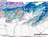
I think this is a reasonable estimate of general potential snow depth by Sunday morning at 7am (from the hi-res NAM).
1612627459264.png
 
We're starting to approach the main window of snow tonight between 10pm and 6am with the main chances in the valley after 2am.

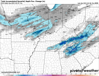
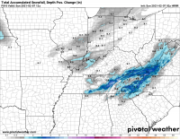
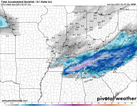
My thoughts pretty much mirror the recent HRRR model runs for snow depth (below). The actual model snowfall output is misrepresentative of the actual accumulations with surface temperatures across most of the valley between 33-36F. For example, the 19z HRRR is showing kuchera snowfall of 1.2" in Knoxville with a 10:1 ratio showing 2.4" in Knoxville. This just seems like too much with surface temperatures above freezing and some rain mixing in reducing actual ratio significantly. The snow depth takes into account the melting at the surface and is more realistic with mostly just a few tenths of an inch of snow for most valley areas tonight.

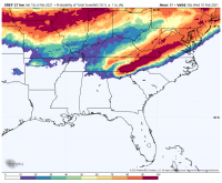
Higher snowfall totals expected across higher elevations where surface temperatures will be a few degrees cooler. This trend is also shown in the SREF probs for 1"+ of snow with low probabilities in the valley.
1612645420600.png
1612645437269.png
 
  • Like
Reactions: cardvolfan
We're starting to approach the main window of snow tonight between 10pm and 6am with the main chances in the valley after 2am.

My thoughts pretty much mirror the recent HRRR model runs for snow depth (below). The actual model snowfall output is misrepresentative of the actual accumulations with surface temperatures across most of the valley between 33-36F. For example, the 19z HRRR is showing kuchera snowfall of 1.2" in Knoxville with a 10:1 ratio showing 2.4" in Knoxville. This just seems like too much with surface temperatures above freezing and some rain mixing in reducing actual ratio significantly. The snow depth takes into account the melting at the surface and is more realistic with mostly just a few tenths of an inch of snow for most valley areas tonight.

Higher snowfall totals expected across higher elevations where surface temperatures will be a few degrees cooler. This trend is also shown in the SREF probs for 1"+ of snow with low probabilities in the valley.
View attachment 348943
View attachment 348944
What’s odd to me is they’re saying up to an inch in Knoxville but up to 4 inches in Oak Ridge. We’re in Hardin Valley so we’re right in between. I’ll randomly guess up to 2 inches here. My guess is about as likely to be accurate as anything else with these timing systems.
 
What’s odd to me is they’re saying up to an inch in Knoxville but up to 4 inches in Oak Ridge. We’re in Hardin Valley so we’re right in between. I’ll randomly guess up to 2 inches here. My guess is about as likely to be accurate as anything else with these timing systems.
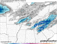
I doubt we see 4" in Oak Ridge. I'd say most likely less than an inch on grassy surfaces. Seems like it's going to be really elevation dependent so probably some higher snowfall totals atop the mountains overlooking Oak Ridge (such as Buffalo Mtn). You can really see the higher elevations stand out in the hi-res models. We'll see snow in the valley; it'll just be difficult to get it accumulating with temps above freezing.
1612660037836.png
 
  • Like
Reactions: hUTch2002
I doubt we see 4" in Oak Ridge. I'd say most likely less than an inch on grassy surfaces. Seems like it's going to be really elevation dependent so probably some higher snowfall totals atop the mountains overlooking Oak Ridge (such as Buffalo Mtn). You can really see the higher elevations stand out in the hi-res models. We'll see snow in the valley; it'll just be difficult to get it accumulating with temps above freezing.
View attachment 349030
We have been so close to some good snow all Winter. I don’t recall ever seeing so many close calls.
 

VN Store


Back
Top