East Tennessee Weather II

Special weather statement for all of East Tennessee.

National Weather Service Watch Warning Advisory Summary
...An Enhanced Risk of Severe Thunderstorms for Sunday Afternoon
and Early Evening across east Tennessee, southwest Virginia, and
southwest North Carolina...

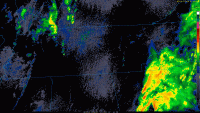
A strong storm system will move across the Tennessee Valley and
southern Appalachians Sunday producing widespread storms. There
is an enhanced risk of severe thunderstorms area-wide during the
afternoon and early evening with the main concern being damaging
winds, isolated tornadoes, and hail up to quarter size.

Due to the tightening of the pressure gradients around this storm
system, windy conditions can also be expected area-wide Sunday.

There is still uncertainty on the evolution of this storm system
with later updates to the potential of severe storms and timing likely
over the weekend. Please keep abreast of the latest forecast
updates from the National Weather Service.
 
57435732_2333295370024966_1027549953242693632_o.jpg

57511464_2333297570024746_6340531863987159040_o.png
 
Whats your opinion on the severe threat Sunday @Vol knight ?

The wind shear looks to be very strong, and the instability is looking decent. I would say that damaging winds up to 70 mph is the primary threat. A couple isolated tornadoes and large hail up to quarter size is also possible. As of now, there’s 2 waves that will come through. The first in the morning hours, then a second line in the late afternoon/early evening timeframe. The second line is the one that l believe has the better chance for severe weather. The main questions are how quick is the first wave going to move through, when does it move through, and will the sun be out in between the storms? IF the sun comes out, we’ll have greater instability and the second line could be really bad.
 
  • Like
Reactions: Matt2496
I may be wrong, but I don’t see moderate risk being issued. The instability doesn’t seem to be forecasted as strong as it is towards Louisiana and Mississippi right now.
You're probably right. There's a scheduled update to the outlook at 1:30 so we'll see.
 
Forgot to post this earlier, but there’s a wind advisory for the valley and plateau in East TN. There’s also a High Wind Warning for the mountains, mainly above 3000 feet. 65+ mph wind gusts are possible in the higher terrain, while up to 45 mph gusts are possible elsewhere.
 
Alert!!!!!

For those who live in Southern Middle TN, there will be a Tornado Watch issued shortly. People in these areas need to be prepared.
 
Rocktopper, did you move to northern GA? I can’t remember. If so, there’s a Tornado Watch issued for your backyard till 2:00 PM EST.
 
Rocktopper, did you move to northern GA? I can’t remember. If so, there’s a Tornado Watch issued for your backyard till 2:00 PM EST.

Yes, strong storms to the south seemed to fizzle them out more north. Pop up storms between now and 4 are and was my concern. Weather down here is just as strange.
 
Well I either slept really hard and didn't hear a thing or this whole event was played up too much?
 
I’m at a wedding right now, so I’m not going to be able to update often. As Matt said, there’s a good chance that a Tornado Watch will be issued in the short term.
 
Fair enough but the majority of the precip. has moved east already so where are these new storms coming from?
 
Alert!!!!

A Severe Thunderstorm Watch has been issued for the eastern half of East TN (including Knoxville) until 10:00 PM EST.
 

VN Store


Back
Top