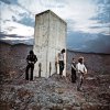
Knoxville guys, what is this thing. Spotted it from upper deck in Neyland.

#2
#2
Looks like several small cell tower/antennas. Weird looking object in the circular clearing. Should be able to find the property owner at kgis.org for 1800 Ridgewood Drive. Doesn't really look like radio or TV broadcasting. Maybe part of Knox County E-911.
 
  • Like
Reactions: 2 people
#3
#3
Looks like several small cell tower/antennas. Weird looking object in the circular clearing. Should be able to find the property owner at kgis.org for 1800 Ridgewood Drive. Doesn't really look like radio or TV broadcasting. Maybe part of Knox County E-911.

It almost looks like a parabolic reflector. There seem to be posts around the perimeter aimed at a focal point in the white post. It might be some sort of navigation for McGee Tyson, however I've never seen something like this. From upper deck, under the jumbotron, it's visible off in the distance. I spotted it at the spring game and made a mental note to look for it on Google earth. Just did - thats how long it takes me to process mental notes..lol.

I'll see if I can find the owner on the link you sent. Thanks.
 
#4
#4
Those do look like lights or something surrounding it. Helping planes line up for TYS approaches seems logical. It seems to be on the path that arriving jets take.
 
Last edited:
#5
#5
Looks like several small cell tower/antennas. Weird looking object in the circular clearing. Should be able to find the property owner at kgis.org for 1800 Ridgewood Drive. Doesn't really look like radio or TV broadcasting. Maybe part of Knox County E-911.

Here is what I found:
Owned by:
UNITED STATES OF AMERICA THE % FED A
PO BOX 20336
ATLANTA GA 30320

Procured in 6/17/1988 for $34,300

I can only speculate on what it is. Anybody else have a clue?

Thanks
 
#6
#6
Here is what I found:
Owned by:
UNITED STATES OF AMERICA THE % FED A
PO BOX 20336
ATLANTA GA 30320

Procured in 6/17/1988 for $34,300

I can only speculate on what it is. Anybody else have a clue?

Thanks

FAA and FCC probably. I tried to find the Ask the Pilot thread but search on my iPad sucks.
 
#7
#7
Here is a different angle of it.

ridgewood.jpg


http://s15.postimg.org/snizgyty3/ridgewood.jpg
 
#9
#9
SpaceCoastVol flies Boeing 7x7s. He has a thread in Politics called Aviation, so I asked him to explain. The post above kind of clears it up though.
 
#13
#13
If you look at the soil around it you can see the rings where the structure to fold away from the rest of the alien craft is hidden under the grass. These are all over the word. In the event of potential nuclear war, the aliens enter their starships and leave. Can be identified in flight by a barely visible wire along flight path and wispy white smoke sorta squirting out the back.

Buck Rogers Over & Out
 
  • Like
Reactions: 4 people
#15
#15
Yes but the question is do computers have feelings? Do they call their mom?
 
#16
#16

It's called VORTAC (VOR/TACAN)

It's just a navigational aid for pilots. Spits out a radio frequency that their equipment can pick up and point them in the right direction. I believe the aircraft side would use a DME (distance measuring equipment).

AirNav: Navaid information

VXV
VOLUNTEER VORTAC
KNOXVILLE, TN

Location

Lat/Long: 35-54-17.419N / 083-53-41.015W (35.9048386/-83.8947264)
Elevation: 1290.0 ft.
Variation: 03W (1985)
Operational Characteristics

Type: VORTAC
Class: H-VORTAC
Frequency: 116.40
TACAN channel: 111X
Altitude code: H (high)
Hours of operation: 24
Voice ID: no
Morse ID: ...- -..- ...-
Station call name: NASHVILLE RADIO
NOTAM facility: TYS
FSS:
FSS hours of operation: 24
Technical Characteristics

Accuracy: NOS
Monitoring: Internal monitoring plus status indicator
at control point
Owner: FEDERAL AVIATION ADMIN
Operator: FEDERAL AVIATION ADMIN
Common system usage: yes
For public use: yes
 
Last edited:
  • Like
Reactions: 2 people
#17
#17
Now that the truth has been revealed, it looks like they chose to build that thingy on the site used to launch model rockets built by 1950s enthusiasts.
 
#18
#18
Now that the truth has been revealed, it looks like they chose to build that thingy on the site used to launch model rockets built by 1950s enthusiasts.

Well its there because it helps line the aircraft up with TYS. If you find it on a map you can draw a pretty straight path towards TYS.
 
#24
#24
It's called VORTAC (VOR/TACAN)

It's just a navigational aid for pilots. Spits out a radio frequency that their equipment can pick up and point them in the right direction. I believe the aircraft side would use a DME (distance measuring equipment).

AirNav: Navaid information

VXV
VOLUNTEER VORTAC
KNOXVILLE, TN

Location

Lat/Long: 35-54-17.419N / 083-53-41.015W (35.9048386/-83.8947264)
Elevation: 1290.0 ft.
Variation: 03W (1985)
Operational Characteristics

Type: VORTAC
Class: H-VORTAC
Frequency: 116.40
TACAN channel: 111X
Altitude code: H (high)
Hours of operation: 24
Voice ID: no
Morse ID: ...- -..- ...-
Station call name: NASHVILLE RADIO
NOTAM facility: TYS
FSS:
FSS hours of operation: 24
Technical Characteristics

Accuracy: NOS
Monitoring: Internal monitoring plus status indicator
at control point
Owner: FEDERAL AVIATION ADMIN
Operator: FEDERAL AVIATION ADMIN
Common system usage: yes
For public use: yes

That's not the volunteer vortac. It is across the river closer to downtown island (dkx).
 
#25
#25
That's not the volunteer vortac. It is across the river closer to downtown island (dkx).

Those coordinates I posted are for the Volunteer VORTAC which is what the OP was asking about.

1800 Ridgewood Drive.

If you got a map loc of another navaid I'd like to check it out.
 
Last edited:

VN Store


Back
Top